
Boundary line associated with India : know everything
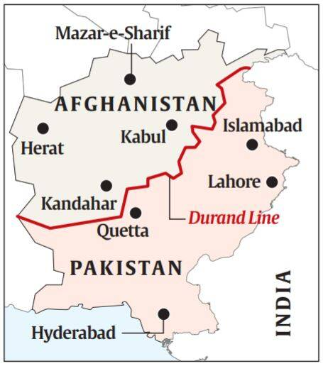
- Established in the Hindu Kush in 1893, it runs through the tribal lands between Afghanistan and British India. In modern times it has marked the border between Afghanistan and Pakistan.
- It is a legacy of the 19th century Great Game between the Russian and British empires in which Afghanistan was used as a buffer by the British against a feared Russian expansionism to its east.
- The agreement demarcating what became known as the Durand Line was signed between the British civil servant Sir Henry Mortimer Durand and Amir Abdur Rahman, then the Afghan ruler in 1893.
- Abdur Rahman became king in 1880, two years after the end of the Second Afghan War in which the British took control of several areas that were part of the Afghan kingdom. His agreement with Durand demarcated the limits of his and British India’s “spheres of influence” on the Afghan “frontier” with India.
- The seven-clause agreement recognised a 2,670-km line, which stretches from the border with China to Afghanistan’s border with Iran.
- It also put on the British side the strategic Khyber Pass.
- It is a mountain pass in the Hindu Kush, on the border between Pakistan and Afghanistan.
- The pass was for long of great commercial and strategic importance, the route by which successive invaders entered India, and was garrisoned by the British intermittently between 1839 and 1947.
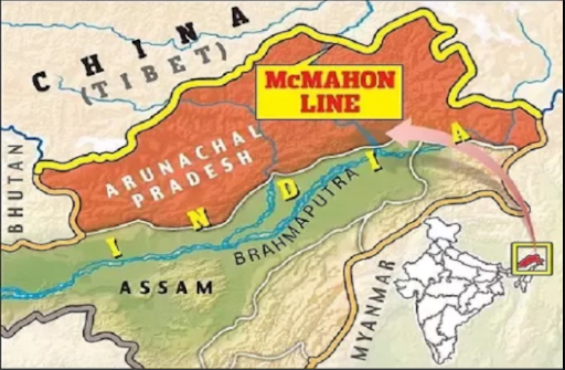
- Named after the British Indian Army officer Lieutenant Colonel Sir Arthur Henry McMahon, who was also an administrator in British India, the McMahon line is a demarcation that separates Tibet and north-east India.
- It was proposed by Colonel McMahon as the boundary between Tibet, China, and India at the Shimla Convention of 1914.
- It runs from the eastern border of Bhutan along the crest of the Himalayas until it reaches the great bend in the Brahmaputra River where that river emerges from its Tibetan course into the Assam Valley.
- It was accepted by Tibetan authorities and British India, and is now acknowledged by the Republic of India as the official boundary.
- China, however, disputes the validity of the McMahon line.
- It claims that Tibet isn’t a sovereign government, and therefore any treaty made with Tibet stands invalid.
- The alignment of the Line of Actual Control (LAC) in the eastern sector is along the 1914 McMahon Line.
- The LAC is the demarcation that separates Indian-controlled territory from Chinese-controlled territory.
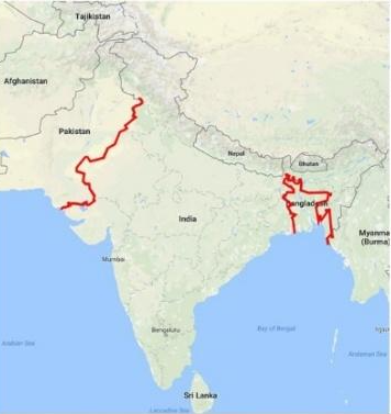
- It divided British India into India and Pakistan.
- It is named after the architect of this line, Sir Cyril Radcliffe, who was also the chairman of the Boundary Commissions.
- The Radcliffe Line was drawn between West Pakistan (now Pakistan) and India on the western side and between India and East Pakistan (now Bangladesh) on the eastern side of the subcontinent.
- The western side of the Radcliffe Line still serves as the Indo-Pakistani border and the eastern side serves as the India-Bangladesh border.